- Monterra
- Paket baterai litium-ion
- kabel USB
- adaptor AC
- Pelindung layar anti silau
- Dokumentasi
 click image to preview
activate zoom
click image to preview
activate zoom

GPS Garmin Monterra
| Stok | Tersedia |
| Kategori | GPS |
Tentukan pilihan yang tersedia!
INFO HARGA
Silahkan menghubungi kontak kami untuk mendapatkan informasi harga produk ini.
Pemesanan lebih cepat!
Quick Order
GPS Garmin Monterra
Pembangkit Tenaga Pemetaan GPS Dengan Android™
- Layar kaca mineral 4″ orientasi ganda, dapat dibaca di bawah sinar matahari, dan tahan lama dengan antarmuka multi-sentuh
- Dapatkan aplikasi Android di Google Play™
- Kamera autofokus 8 megapiksel dan video HD 1080p dengan geotagging otomatis, lampu kilat/obor LED
- Penerima GPS/GLONASS sensitivitas tinggi untuk penentuan posisi yang lebih baik
- MapMerge™ 3D untuk banyak peta dalam 3-D
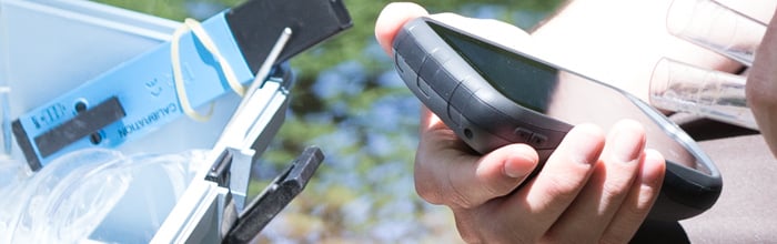
Monterra adalah navigator GPS berkemampuan Wi-Fi® berfitur lengkap yang menggabungkan pemetaan canggih kami dengan keserbagunaan Android. Dapatkan aplikasi Android untuk Monterra di Google Play, termasuk PeakFinder, bagan konstelasi bintang, dan kalkulator balistik. Atau akses aplikasi profesional seperti estimator konstruksi dan ArcGIS® untuk memperluas kantor Anda hingga ke lapangan. Monterra yang kokoh dan tahan lama memiliki kekuatan dan fleksibilitas untuk dibawa kemana saja.
Penggabungan Peta 3D
Monterra adalah alat pemetaan terbaik dengan pemetaan 3-D khusus. Gabungkan 2 peta, misalnya Citra Satelit TOPO dan BirdsEye, lalu lihat kedua peta dalam 3-D. Anda akan melihat tekstur yang kaya, seperti bukit, lembah, danau, dan hutan. Memperbesar, memperkecil, dan memutar peta 3-D menggunakan multi-sentuh.
Foto Berkualitas
Monterra dilengkapi kamera digital autofokus 8 megapiksel internal yang mengambil foto dengan jelas dan diberi tag geografis untuk memudahkan navigasi kembali ditambah kamera video HD 1080p dengan lampu kilat/obor LED. Anda dapat mengunduh foto dan video dengan mudah ke komputer Anda atau untuk dibagikan melalui Garmin Adventures . Monterra memiliki banyak memori internal ditambah slot kartu microSD™ untuk memori tambahan hingga 64 GB.
Baterai Kuat, Tampilan Cantik
Monterra memiliki sistem baterai ganda yang canggih. Anda dapat menggunakan paket litium-ion yang dapat diisi ulang (disertakan) atau baterai AA tradisional — paket litium-ion akan mengisi daya saat perangkat tersambung ke daya eksternal. Layar multi-sentuh 4″ warnanya menggunakan cahaya eksternal dan sinar matahari yang dikombinasikan dengan lampu latar LED untuk meningkatkan kecerahan layar. Selain itu, Anda menghemat daya dengan tidak perlu menyalakan lampu latar.
Dapatkan Arah Anda
Monterra memiliki kompas elektronik 3 sumbu bawaan dengan akselerometer dan gyro, yang menunjukkan tujuan Anda bahkan saat Anda berdiri diam (atau tidak menjaganya tetap rata). Setelah dikalibrasi, altimeter barometriknya melacak perubahan tekanan untuk menentukan ketinggian tepat Anda, dan Anda bahkan dapat menggunakannya untuk merencanakan tekanan barometrik dari waktu ke waktu, yang dapat membantu Anda mengawasi perubahan kondisi cuaca.
Sensor UV internal memungkinkan Anda mengetahui tingkat paparan sinar matahari sehingga Anda dapat menghindari kerusakan akibat sinar matahari, terutama pada ketinggian yang lebih tinggi (peningkatan intensitas sebesar 5 persen setiap ketinggian 1.000 kaki) dan pada permukaan terang atau reflektif (salju, air, dll) . Dan dengan penerima GPS berkemampuan WAAS dan GLONASS dengan sensitivitas tinggi, Monterra menemukan posisi Anda dengan lebih presisi dan mempertahankan lokasi GPS bahkan di tempat yang tertutup rapat dan ngarai yang dalam.
Bagikan Secara Nirkabel
Dengan Wi-Fi, Bluetooth®, dan NFC, Monterra memungkinkan Anda berbagi data, peta, titik arah, trek, rute, dan geocache hingga 50 kali lebih cepat dengan perangkat nirkabel lain yang kompatibel. Plus, Anda dapat berbagi foto dan data dari kerja lapangan melalui BaseCamp ™ atau dengan mengunduh langsung ke komputer Anda.
Muat Peta dan Geocache
Tambahkan Citra Satelit BirdsEye (perlu berlangganan) dan ikuti jejaknya. Tambahkan peta TOPO Trailhead Series dan jelajahi jalur terkenal seperti Appalachian Trail dan Pacific Crest Trail. Atau, muat peta berbasis GIS Anda dan mulai bekerja.
Monterra dapat menyimpan ribuan geocache. Download setiap cache yang ada di ikomunika.com . Muat cache dari GSAK. Atau dapatkan aplikasi Android favorit Anda di Google Play. Semua fitur geocaching tanpa kertas Anda akan tersedia untuk setiap cache. Baca deskripsi lengkap, petunjuk dan log. Lihat foto cache. Filter cache berdasarkan ukuran, medan, kesulitan dan jenis. Hubungkan ke cache yang mendukung chirp ™.
Radio
Jangan pernah melewatkan informasi penting (atau hiburan) dengan radio FM bawaan Monterra dan radio cuaca NOAA dengan peringatan SAMA. Dapatkan jam tangan dan peringatan terkait lokasi Anda. Dengarkan dengan headphone atau bagikan dengan seluruh grup melalui speaker internal.
Rencanakan Perjalanan Anda Berikutnya
Kendalikan petualangan Anda berikutnya dengan BaseCamp, perangkat lunak yang memungkinkan Anda melihat dan mengatur peta, titik arah, rute, dan trek. Ciptakan Garmin Adventures untuk dibagikan kepada teman, keluarga, atau sesama penjelajah. BaseCamp menampilkan data peta topografi dalam 2D atau 3D di layar komputer Anda, termasuk garis kontur dan profil ketinggian. Itu juga dapat mentransfer gambar satelit dalam jumlah tak terbatas ke perangkat Anda saat dipasangkan dengan langganan Citra Satelit BirdsEye.
Pasang Di Mana Saja
Dengan serangkaian dudukan yang kompatibel, Monterra dirancang untuk digunakan pada ATV, di kapal, sebagai perangkat genggam, atau di mobil Anda. Gunakan dudukan mobil untuk petunjuk arah mengemudi secara lisan, belokan demi belokan, atau dudukan kokoh untuk sepeda motor atau ATV Anda.
Dalam kotak :
Penampilan fisik |
|
| Dimensi fisik | 2,9″ x 5,9″ x 1,4″ (7,48 x 14,96 x 3,63 cm) |
| Ukuran tampilan, LxT | 2″L x 3,5″T (5,06 x 8,93 cm); diameter 4″ (10,2 cm) |
| Resolusi tampilan, LxT | 272×480 piksel |
| Tipe tampilan | TFT warna 65k yang cerah dan transflektif, layar sentuh orientasi ganda; sinar matahari dapat dibaca |
| Layar sentuh | |
| Berat | 11,7 oz (331 g) dengan paket baterai litium-ion yang disertakan; 13,2 oz (375 g) dengan 3 baterai AA (tidak termasuk) |
| Baterai | lithium-ion yang dapat diisi ulang (termasuk) atau 3 baterai AA (tidak termasuk); NiMH atau Lithium direkomendasikan |
| Daya tahan baterai | hingga 16 jam (lithium-ion); hingga 22 jam (baterai AA) |
| Peringkat air | IPX7 |
| Penerima sensitivitas tinggi | |
| Antarmuka | USB berkecepatan tinggi |
| Kamera | ya (8 megapiksel dengan fokus otomatis dan video 1080p/30fps; lampu kilat LED; penandaan geografis otomatis) |
| Altimeter barometrik | |
| Kompas elektronik | Ya (3 sumbu dengan kompensasi kemiringan) |
| Transfer unit ke unit (berbagi data secara nirkabel dengan unit serupa) | |
Peta & Memori |
|
| Peta dasar | |
| Peta yang dimuat sebelumnya | ya (topografi), beberapa model |
| Kemampuan untuk menambahkan peta | |
| Memori bawaan | 6 GB (Dengan Peta Dasar Seluruh Dunia); 3 GB (Dengan Peta TOPO US 100K) |
| Menerima kartu data | kartu microSD™ (tidak termasuk) |
| POI khusus (kemampuan untuk menambahkan tempat menarik tambahan) | |
| Titik arah/favorit/lokasi | 4000 |
| Rute | 200 |
| Lacak log | 10.000 poin, 200 trek tersimpan |
Fitur Luar Ruangan |
|
| Perutean otomatis (perutean belokan demi belokan di jalan raya) | Ya (dengan pemetaan opsional untuk detail jalan) |
| Ramah geocaching | Ya (Tanpa Kertas) |
| Kompatibel dengan peta khusus | |
| Perhitungan luas | |
| Penampil gambar | |
Garmin Connect™ |
|
| Kompatibel dengan Garmin Connect™ (komunitas online tempat Anda menganalisis, mengkategorikan, dan berbagi data) | |
Tambahan |
|
| Tambahan |
|
Tags: Garmin Indonesia, Garmin Monterra, GPS Garmin, GPS Garmin Monterra
GPS Garmin Monterra
| Berat | 400 gram |
| Kondisi | Baru |
| Dilihat | 512 kali |
| Diskusi | Belum ada komentar |
Produk Terkait
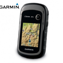
GPS Garmin ETrex 30x
Spesifikasi Detail GPS Genggam, Kompas 3-sumbu: Resolusi dan Memori Lebih Baik Resolusi lebih besar dengan piksel tampilan 240 x 320 untuk meningkatkan keterbacaan Memori internal menampung untuk menampung lebih banyak peta Peta dasar seluruh dunia dengan relief berbayang Layar 2,2 inci, 65K warna , dapat dibaca di bawah sinar matahari 3- kompas sumbu dan altimeter… selengkapnya
*Harga Hubungi CS Tersedia
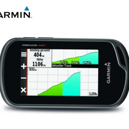
Garmin GPSMap Oregon 600
Suplier Alat GPS Beragam tipe yang memudahkan pekerjaan Anda/perusahaan dengan harga yang sangat terjangkau dan kompetitif. Deskripsi : GPS Garmin Oregon 600 Lebih Banyak Fitur, Lebih Banyak Kekuatan Satelit Di Balik Layar Sentuh Terberat dan Terang kami Tampilan layar sentuh 3″ yang dapat dibaca di bawah sinar matahari dengan orientasi ganda Kompas 3 sumbu dengan… selengkapnya
*Harga Hubungi CS Tersedia
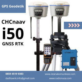
GPS Geodetik RTK CHCnav i50
GPS Geodetik CHC I50 GNSS menghadirkan kecepatan dan akurasi dalam satu solusi GNSS yang mudah digunakan untuk menyelesaikan survei dan proyek konstruksi Anda secara efisien. Dikombinasikan dengan perangkat lunak lapangan CHCNAV LandStar 7 dan pengontrol Android HCE320, i50 adalah solusi survei yang sempurna untuk tugas penentuan posisi topografi dan konstruksi. Fitur GPS Geodetik CHC I50… selengkapnya
*Harga Hubungi CS Tersedia
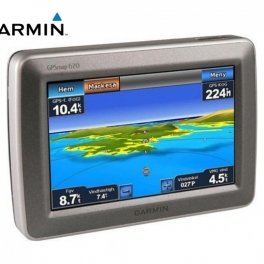
Garmin GPSMap 620
Detil Suplier Alat GPS Beragam tipe yang memudahkan pekerjaan Anda/perusahaan dengan harga yang sangat terjangkau dan kompetitif. Ikhtisar Menavigasi melalui darat dan laut dengan GPSMAP 620. Chartplotter kelautan berfitur lengkap ini melakukan tugas ganda dengan mode otomotif yang siap berangkat segera setelah Anda mencapai pantai saat dilengkapi dengan peta jalan opsional City Navigator® NT… selengkapnya
*Harga Hubungi CS Tersedia
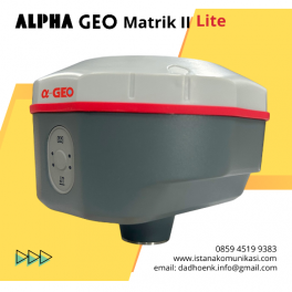
GPS Geodetik GNSS ALPHA Geo Matrik II Lite
GNSS Alpa Geo Matrik II Lite GPS RTK GNSS Alpha Geo Matrix II Lite GNSS Alpha Geo MATRIX II Lite adalah perangkat GNSS generasi terbaru yang ringkas dan cerdas, dirancang untuk berbagai proyek survei dengan teknologi terkini. Sudut Kompensasi IMU Mode Jaringan >24 jam Perlindungan IP IP67 tahan debu Keterangan GNSS MATRIX II Lite –… selengkapnya
*Harga Hubungi CS Tersedia
Paling Laris

Jual Murah ” GPS Magellan eXplorist Pro 10 GNSS Driver + EZSurv
Suplier Alat GPS Beragam tipe yang memudahkan pekerjaan Anda/perusahaan dengan harga yang sangat terjangkau dan kompetitif. Driver GNSS eXplorist Pro10 + EZSurv Kasar dan tahan air untuk kondisi ekstrim Kamera digital, speaker, dan mikrofon terintegrasi Konektivitas nirkabel Bluetooth ke perangkat berkemampuan Bluetooth Penyimpanan memori Kartu Micro SDHC yang dapat diperluas EZSurv Pasca-pemrosesan memungkinkan akurasi dan… selengkapnya
*Harga Hubungi CS Tersedia
Paling Laris

Jual Murah ” GPS Magellan eXplorist Pro + EZTagCE
Suplier Alat GPS Beragam tipe yang memudahkan pekerjaan Anda/perusahaan dengan harga yang sangat terjangkau dan kompetitif. eXplorist Pro10 dengan EZTagCE Kasar dan tahan air untuk kondisi ekstrim Kamera digital, speaker, dan mikrofon terintegrasi Konektivitas nirkabel Bluetooth ke perangkat berkemampuan Bluetooth Penyimpanan memori Kartu Micro SDHC yang dapat diisi Perangkat lunak EZTag CE dengan pengambilan dan… selengkapnya
*Harga Hubungi CS Tersedia
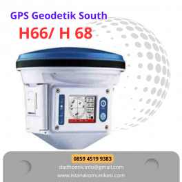
GPS Geodetic South H66 H68
GPS Geodetic South H66/H68 Unit terintegrasi yang praktis, kompak dan kokoh, tersegel dengan baik untuk tahan air dan tahan debu Remote control nirkabel, nyaman untuk pengoperasian cerdas Baterai ganda yang dapat diganti secara otomatis untuk catu daya hingga 16 jam kerja Kekompakan tinggi, mampu bekerja dengan merek lain atau bahkan penerima frekuensi ganda untuk pengawasan… selengkapnya
*Harga Hubungi CS Tersedia

Jual Murah ” GPS Trimble Juno SD
Suplier Alat GPS Beragam tipe yang memudahkan pekerjaan Anda/perusahaan dengan harga yang sangat terjangkau dan kompetitif. Solusi lapangan terbaik untuk manajemen aset dengan kemampuan suara dan data 3,5G Perangkat genggam Juno® SD adalah perangkat genggam yang tahan lama dan ringan yang mengintegrasikan serangkaian fitur canggih. Menyediakan data seluler terintegrasi dan kemampuan panggilan suara, pengambilan foto,… selengkapnya
*Harga Hubungi CS Tersedia
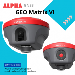
GPS Geodetik GNSS ALPHA Geo Matrix VI
Matriks Geo GNSS ALPHA VI Matrix Vl adalah GNSS Receiver fungsional terbaru yang menggabungkan teknologi Visual Positioning, penentuan posisi AR pemandangan nyata, dan pengukuran laser. Perangkat ini sekali lagi menerobos batasan produk GNSS, memberikan kemudahan lebih bagi surveyor serta solusi yang lebih produktif. … selengkapnya
*Harga Hubungi CS Tersedia

Belum ada komentar, buka diskusi dengan komentar Anda.